Lake guide
Taylorsville Lake Guide: The Closest Big Lake to Louisville
Taylorsville Lake, under an hour from downtown Louisville: the marina and rentals, four free ramps, Taylorsville Lake State Park trails and camping, the Corps visitor center and dam, fishing and live lake levels.
Taylorsville Lake level right now
1.07 ft below summer pool (547 ft) · 0.93 ft above winter pool (545 ft)
- Release from the dam (outflow)50 cfs
- Water temperature68.4 °F
Provisional real-time data from federal agencies; it can change after review. Checked Oct 28, 2026, 5:44 PM ET.
Heads up: we're an independent guide. Some links may earn us a referral fee, which never changes what you pay or what we recommend. Conditions change fast on the water, so confirm closures and levels with the official source. How we make money.
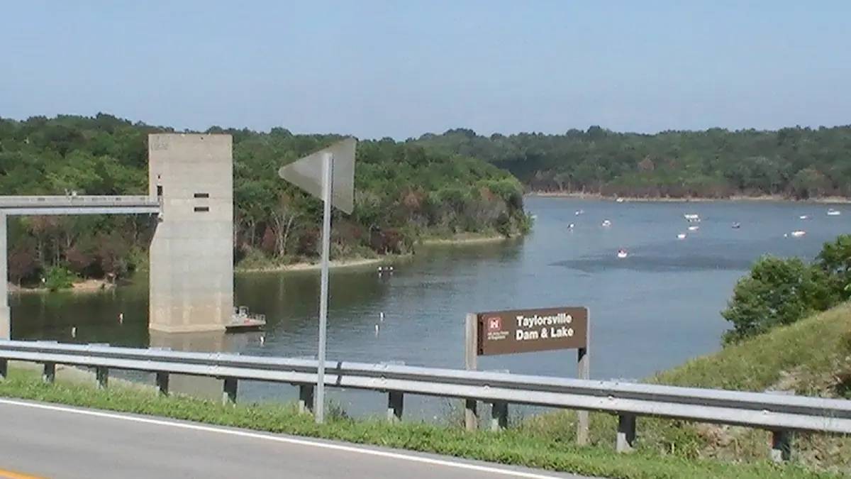
Taylorsville Lake is a U.S. Army Corps of Engineers reservoir on the Salt River in Spencer, Anderson and Nelson counties. It is the closest big lake to Louisville. You can leave downtown after lunch and be on the water mid-afternoon. The lake covers 3,050 acres surrounded by more than 12,000 acres of public land, including a state park known for its horse and bike trails and a 9,417-acre wildlife management area.
Season note: Taylorsville Lake Marina posted that its 2026 season ends October 31. The four main public ramps are listed as open year-round, and the lake drops only about 2 feet in winter. That makes Taylorsville the most reliable close-in launch in the off-season. Check the Taylorsville Lake level.
Marina and rentals
Taylorsville Lake Marina (Settlers Trace Rd, Taylorsville) has fuel, a bait shop, boating and fishing supplies, a full-service grill, and daily pontoon and jet ski rentals, plus open and covered slips. Rental rates and hours change by season, so book on the marina's site.
Boat ramps
Kentucky Fish and Wildlife lists four main ramps. All are paved, multi-lane and free, and all are listed as open year-round, 24 hours:
- Settlers Trace, at the marina
- Possum Ridge
- Van Buren
- Chowning Lane (off Highview Church Rd, south of Taylorsville): courtesy dock, 51+ parking spaces
Taylorsville Lake State Park
The state park covers about 1,200 acres along the lake. It has a multi-use trail system for hiking, mountain biking and horseback riding, an equestrian campground, a campground with RV and tent sites, and lake access. The park staff describe it as halfway between Louisville and Lexington.
Corps visitor center, dam and tailwater
Start at the Corps visitor center and overlook by the dam (usually open weekdays). It has exhibits, a lake view and about 2.5 miles of short trails. Below the dam, the tailwater area is a popular bank-fishing spot with a picnic shelter. Stay well clear of the outlet when water is being released.
Fishing
Kentucky State Parks highlights bass, bluegill and crappie, and Kentucky Fish and Wildlife's fishing forecast lists Taylorsville as a good bet for crappie.
Water temperature
Taylorsville is one of the few nearby lakes with a federal water temperature reading. USGS gauge 03295597 near the dam reports it, and we show it on the Taylorsville Lake level page. It is a gauge reading at one spot and depth, not the temperature at a beach.
Food nearby
The marina grill is the only place to eat on the water. See restaurants on the water. The town of Taylorsville is a short drive away.
FAQ
What is the closest lake to Louisville for boating?
Is there a lake water temperature reading for Taylorsville?
Are Taylorsville Lake boat ramps free?
Does Taylorsville Lake drop in winter?
When does Taylorsville Lake Marina close for the season?
Sources
Checked October 28, 2026. Agencies first; businesses are linked so you can confirm hours and prices with them directly.
- Taylorsville Lake recreation (acreage, visitor center, trails, WMA) (U.S. Army Corps of Engineers, Great Lakes and Ohio River Division)
- Taylorsville Lake water data (U.S. Army Corps of Engineers)
- USGS 03295597 Taylorsville Lake near Taylorsville, KY (U.S. Geological Survey)
- Taylorsville Lake State Park facility details (Kentucky State Parks (ReserveAmerica))
- Kentucky Life: Taylorsville Lake State Park (PBS / KET)
- Chowning Lane ramp (Kentucky Department of Fish and Wildlife Resources)
- Taylorsville Lake ramp (Possum Ridge / Settlers Trace / Van Buren listings) (Kentucky Department of Fish and Wildlife Resources)
- Kentucky fishing forecast (Kentucky Department of Fish and Wildlife Resources)
- FY2024 Interagency Recreation Visitation Data Report (Recreation.gov / RIDB)
- Taylorsville Lake Marina (marina website)